And on the third day of the geology short course spring break trip our professors gave to us, a near death experience in Utah.
We started our day off bright eyed, bushy tailed, and naively optimistic. After a restful stay in Tuba City we packed up the vans and headed out to our first geologic site of the day. We started our day with a short hike out to the iconic Horseshoe bend in the Colorado River. An astoundingly beautiful geologic wonder, it is no surprise that this was one of our busiest stops, with tourists abound and geology students a plenty.
The horseshoe bend is a geologic anomaly because of the meander river system found nestled within a deep canyon. This is remarkable because meander rivers are typically found in areas of low topographic relief. How then does the meander river end up in the canyon? These queries were silenced by Arlo’s explanations. The horseshoe bend was created through rapid uplifting of the landscape in a process called delamination. Delamination involves the vertical removal of the lithosphere. As the asthenosphere comes in to replace the lithospheric material it causes rapid upwelling and erosion, making it possible for the canyon to develop around the river. Though this is an area of debate amongst geologists, this is likely a relatively young event, occurring around 5-6 million years ago.

After some bickering from Don and Arlo, we gleaned that the geology of the canyon is composed primarily of the Navajo formation. This sandstone formation is Jurassic in age and characterized by very fine, well rounded, and well sorted grains, indicating an aeolian depositional environment. They represent an erg, a very large and flat sand sea that covered much of the four corners. Additionally, we observed large scale cross bedding with apparent truncations. These truncations were very graciously modeled to us by Don.

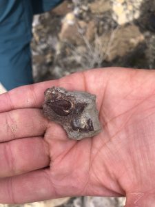
Don also pointed out to us the concretions on the surface of the sandstone. He explained that these were secondary diegenetic hematite formation, caused by water and microbial interactions with the sandstone.
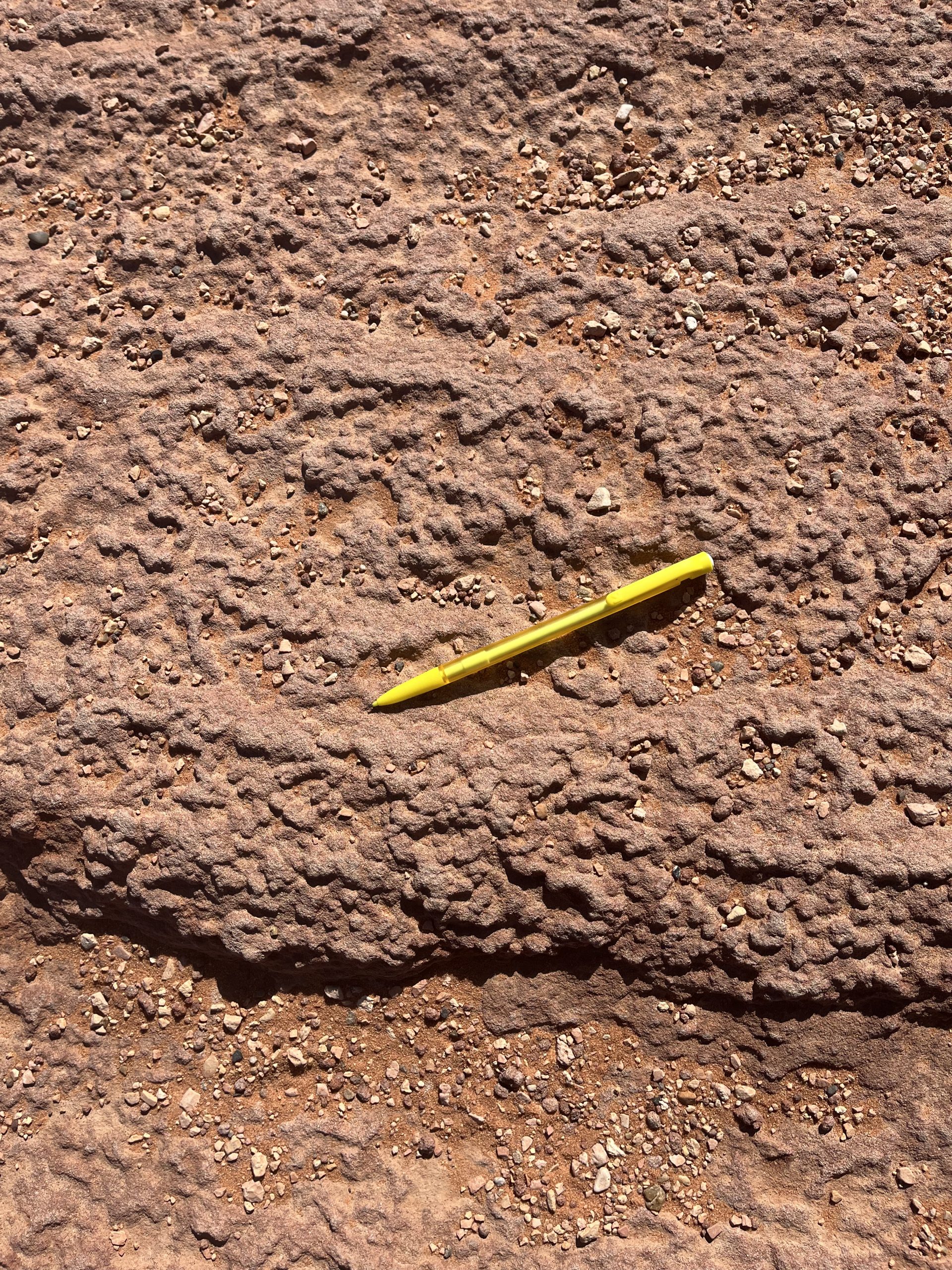
Selby gave us fascinating insights into these features. She described how similar hematite concretions exist in martian craters. Nicknamed blueberries, these formations are evidence of groundwater and microbes which has very interesting implications. Neat!


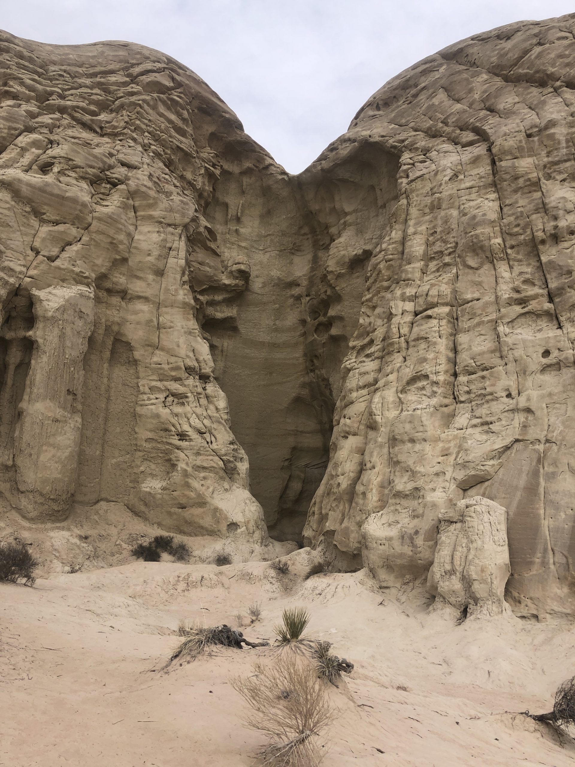
After the beautiful sights of Horseshoe Bend, we took a trip into Utah to check out the Toadstool Hoodoos. A hoodoo is a thin column of rock typically topped by a more resistant piece of rock. As rock is eroded away, the less easily eroded material on top of a hoodoo protects it from being completely weathered away.
When we arrived at our stop, immediately after opening the doors of the vans, we were sandblasted. Gusts of wind swept sand into our eyes and teeth. It was pretty gross.
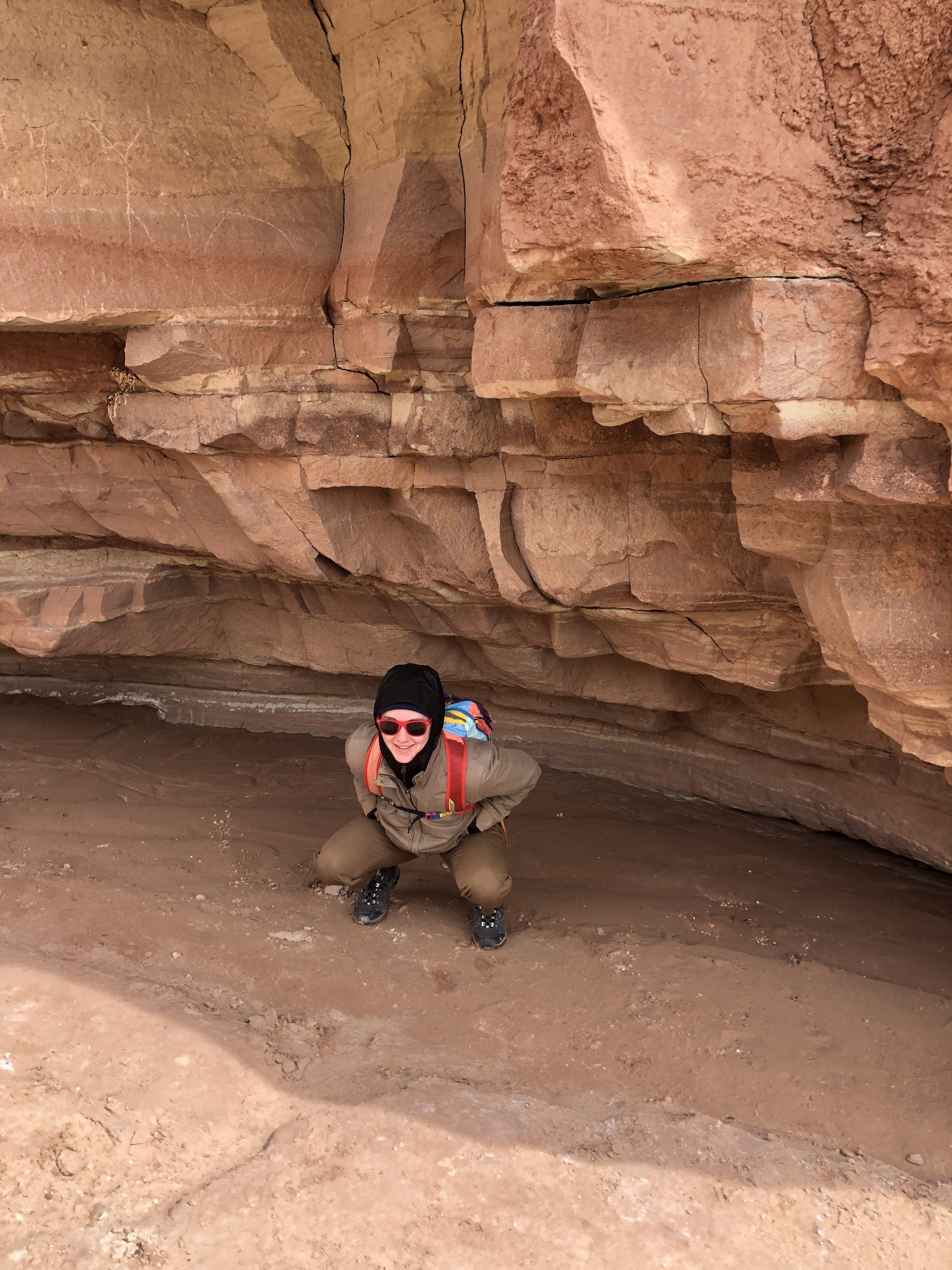
We started along a short hike to get to the hoodoos themselves. At first we followed the path made in the sand by a stream before realizing that wasn’t actually the trail. But before we figured it out we found some pretty cool cut banks.
We soon realized Arlo was walking on the real trail and not purposefully cutting ahead of us, so we followed him the rest of the way to the hoodoos.
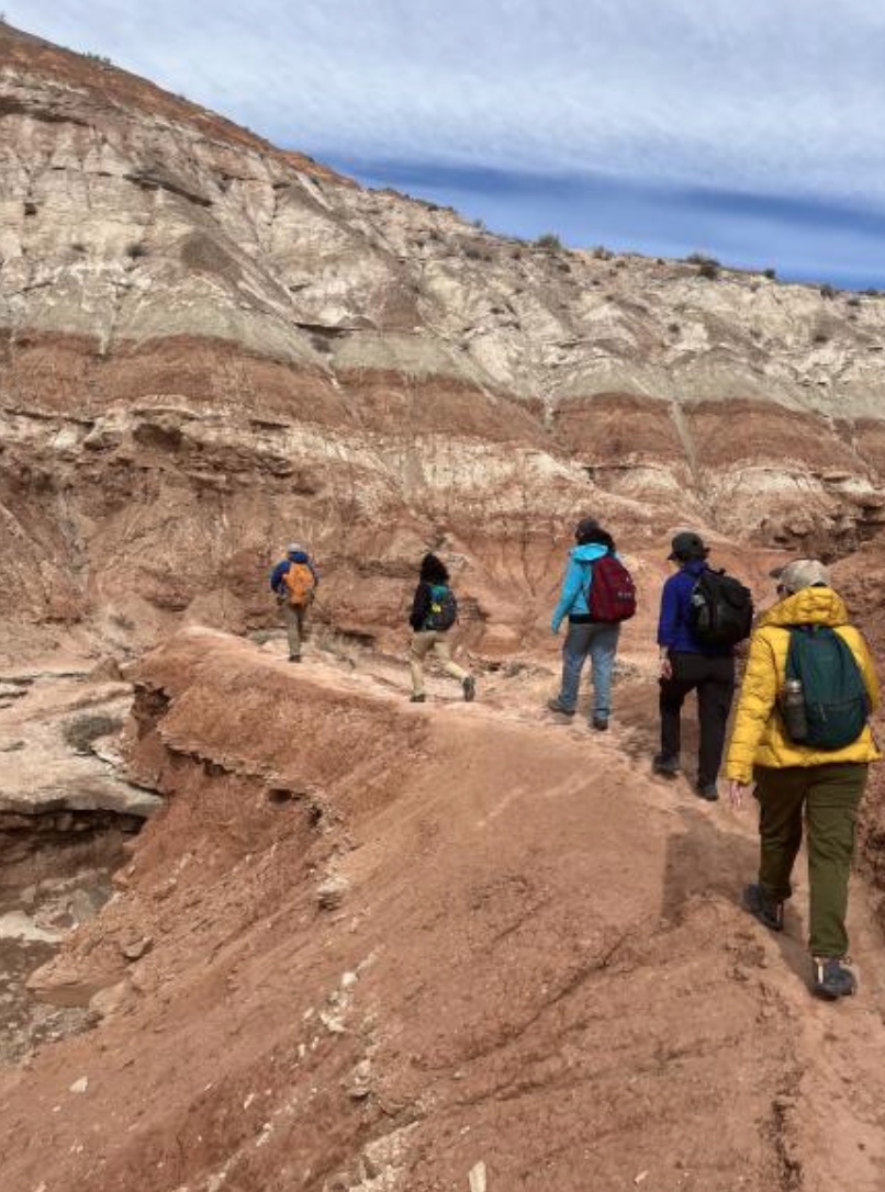
Soon, we made it to a wide open area with many hoodoos of different shapes and sizes. We noticed that most of the hoodoos were made of red sandstone but their tops looked completely different.

The red sandstone, as well as the bleached rock below it, are part of the Entrada Sandstone, a late Jurassic formation. The deposition environment was mainly fluvial.

The cliffs of white rock seen in the background of the last two photos are of a different formation– the Dakota Formation. The sediment in this formation was deposited in the early Cretaceous and in a more marine environment. The darker beds of this formation that we saw at the top of the cliffs were specifically from a tidal or subtidal depositional system.
And these dark beds are also…
The tops of the hoodoos!
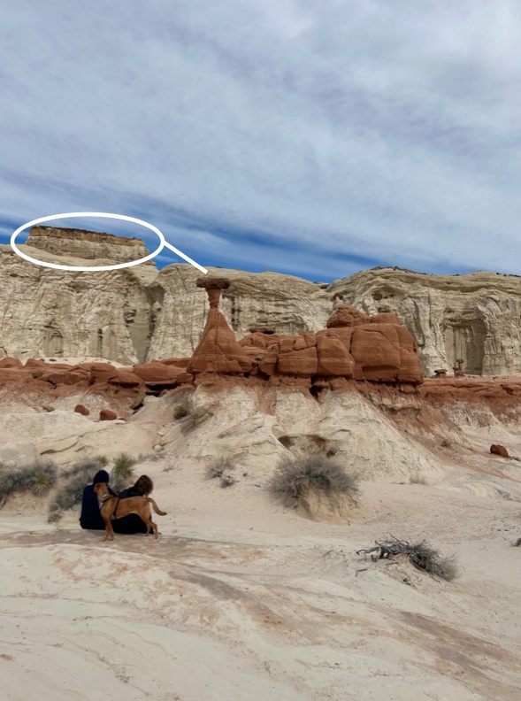
As the Entrada and Dakota eroded away, the more resistant, darker beds of the Dakota stayed together in large pieces and fell onto lower-lying Entrada, and some lighter-colored Dakota. As that rock eroded away as well, the new hoodoo tops helped to shelter the material underneath from the elements. This created thin columns of less resistant rock with more resistant Dakota on top.
We stuck around to take some fun photos and get a crash course on the formation of these hoodoos from Arlo and Don.

Then we hit the road!
Next we ambled our way down a long dirt road to get out of the wind for our lunch stop.
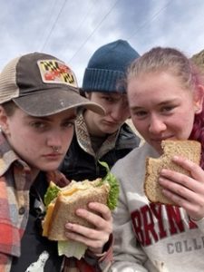
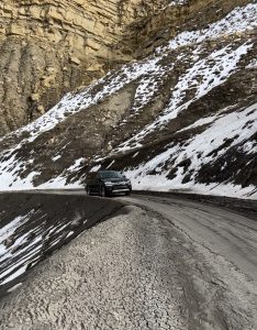
After we finished our scrumptious sandwiches, we fought our way further down the mud road and then disaster struck. After a recent rainfall, Mud Road began living up to its name, and it wasn’t quite done yet.
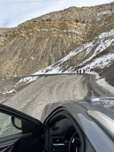
Stopped by a steep and muddy slope, our three fearless leaders decided to send a token car, driven by Arlo and containing important cargo (Arlo’s precious daughter, Aryn, and a few disposable geology students) down the slope. After a successful trip down and back up, there was substantial evidence that we would survive.
Unfortunately this was relatively short lived. Another mile down the road, an even steeper and muddier slope brought our convoy to a screeching stop. Students, daughter, and professors alike tried their hardest to put on brave faces as the sadness of missing out on the incredible Cottonwood Slot Canyons and Grosvernor Arch settled in our pounding geologist hearts.

It took absolutely no deliberation for Arlo to decide this one was a no-go, as there was already a fallen soldier shackled in the mud at the base of the slope.
After a shitty U-turn that left a print of the bumper of the Phreomag (Arlo’s Chevy Suburban) in the black shale outcrop, we stumbled upon a fairytale outcrop that perfectly represented all the amazing things about the Cretaceous Interior Seaway and even offered an insight into the laramide monocline formation.
Laramide monoclines form when a layer of sediment forms over the top of a high angle reverse fault and the fault creates uplift. This leaves the sediment layers forming a blanket-like bulge over the uplifted edge of the rock formation below it.
The Cretaceous Interior Seaway formed during the Cretaceous period (surprise!) which began 145 million years ago and ended 66 million years ago and saw much more shortening of the North American continent than the previous Jurassic period did. This is because the Atlantic ocean was opening up via mid ocean spreading, which actually added more material to the continent on top of just shortening from tectonic pressure. This resulted in mountain building (The Rocky Mountains) which pulled the crust down. Think of a bowling ball being suspended by a towel. The deepest parts will be closest to the mountains. The basin that this process formed became the Cretaceous Interior Seaway that stretches across the entire continent. Evidence of the seaway manifested itself in some adorable bivalves cozied up in some rocks for the rest of eternity, as well as some other marine fossils preserved in rocks.
As a fun challenge, Arlo instructed us all to draw stratigraphic diagrams of the outcrop. Some turned out better than others.

As we manifested our innermost mountain goat selves and clambered along the loose faces of the outcrop, we discovered that above the beautifully white sandstone there was brown and black shale hugging some preserved coal beds.


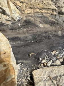
This indication of marine to marsh and back to marine indicated a fluctuation of water level over time, possibly the result of the interior seaway attempting to kickstart.
As the slab flattens out from the shortening, the basin becomes torn up, forcing mountains up. Some of these boast jagged formations at the top, which are known as hogbacks.

Following our departure from our impromptu wilderness stop, we headed with vigor back towards the first muddy slope. Cattle cheered us on as we neared our looming obstacle.

Following Arlo’s expert lead and taking over the reins of Florence The Machine (Selby’s Ford Expedition), Don made two successful trips up nature’s warp wall.
After Don’s panic about a nearly forgotten interview led him to blow past Arlo and his secretly planned destination, the convoy was reunited at Wahweap point overlooking what is left of Lake Powell. As proven by the rounded clasts under our feet, the Paleo Colorado River once rushed through the desert, reaching a water level as high as our feet at that moment. Climate change and water mismanagement have tragically shrunk this beautiful water body to only a puddle amidst towering rocks of Page, Arizona.

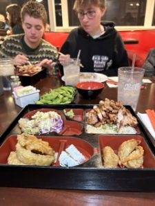
After a long day of traversing terrain and saying “whoa dude,” we were kindly treated to New York Teriyaki.
And finally, we lay our heads to rest on the soft beds for our first night at the Home2Suites in Page, Arizona.
Quote of the day: “I’m a simple girl. I go on Zillow, I pee, and I go to Aliberto’s” -Alison
Number of Taylor Swift sing alongs: 3
Number of cows observed: many
Blog written by Sam, Morgan, and Malin
One response to “Storytime: Hero Geology Professor Saves Students From Imminent Death in Utah Canyon (Day 3)”
Thank you for writing this post!