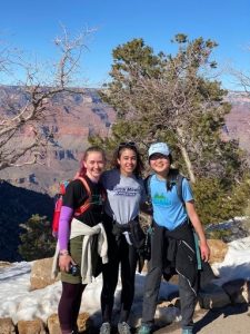
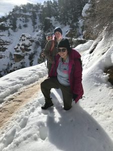
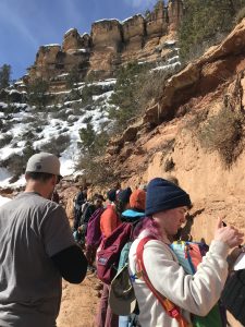
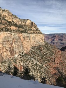
Welcome to Day 6 of our Arizona adventure, the day that a lot of us have been waiting for with great anticipation — our hike down the grandmother of all canyons: the Grand Canyon. We got an early 8:00 AM start with a parking lot breakfast and sandwich making session and hit the road.
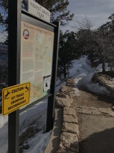
Our original goal was to hike a 9.2 mile round trip down to the Indian Gardens stop and back along the famous Bright Angel Trail. According to Arizona State University this trail was first used by “ancient hunter-gatherers who likely followed animal paths into the Canyon and then over time improved their own trails. Today evidence of their use of this path can be found in the many pictographs dotting the Canyon walls along the trail depicting successful hunts and giving future visitors directions. Havasupai, and probably other tribes who came to visit or trade with them, later wore down a more definite path along this route in their travels between the South Rim and Indian Garden, about a five mile trek below the rim. This was a valuable site to the Havasupai because of the perennial waters of what is now called Garden Creek, which they used to water the fields of crops they maintained there, and because of nearby sheltering caves.”
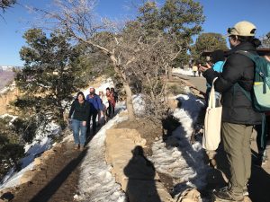
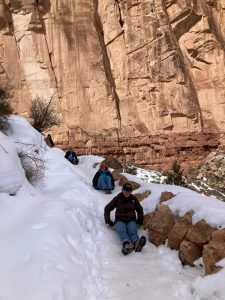
(More on the history here: https://grcahistory.org/sites/rim-to-river-and-inner-canyon-trails/bright-angel-trail/) Unfortunately, Mother Nature had other plans for us, and the trail was pretty snowy and icy near the top.
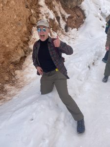
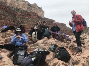
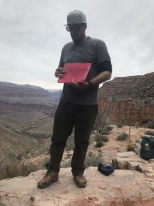
After determining that we could at least start the trail without violating Selby’s Rules (1. NO DEATH and 2. No grievous bodily injury), we began to slowly and carefully make our way down the trail. It turns out that hiking on ice is a great demonstrator of some of the principles of Structural Geology. Arlo, our short king, has taught us that the normal force goes perpendicular to a surface and the shear force goes parallel to it. In rocks, shear force can cause failure. In humans walking on ice, exerting a shear force between your boots and the ice can also cause failure! Selby reminded us to “walk like penguins” a.k.a exert normal force downward when you step.
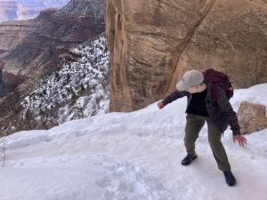

Past the 1.5 Mile rest stop, we finally started to get below the snow line, and got our feet on some sweet sweet dirt. We started moving faster after that and in the end made it about 3.5 miles down the trail into the Cambrian (more on that later), for a grand total of 7 ish miles. Not quite as far as we wanted to go, but the Southwest is so dry these days we can’t begrudge the Grand Canyon her snow.
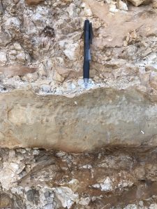
Our first rock stop was the Kaibab Limestone unit, which dates from the early Permian. Arlo prompted us to notice the variation in materials at the outcrop. We noted that there was fine grained limestone with a lenticular habit. Based on its color and appearance, we inferred that the limestone had probably experienced dolomitization, a diagenetic process where some of the calcium in the rock is replaced with magnesium. We also noticed some layers that were very broken up with brittle fractures – a very different behavior. We identified these layers as chert, a type of microcrystalline quartz. Chert forms from tiny marine critters that incorporate silica into their skeletons much like how molluscs use calcite to form their shells. Shoutout to Malin for remembering the terminology “siliceous ooze” from Mineralogy class. The Kaibab represents a “mid-marine” environment – shallow enough that limestone can still form, but well below wave base.
As we traveled down the hill we encountered a surprising number of other Grand Canyon enthusiasts. Notable among them were a couple of badass runners, a child wearing Uggs and without a care in the world, and a guy who got the memo to wear the same outfit as Arlo!

Soon we noticed that we had transitioned out of the Kaibab and into a new unit. This one was redder in color and more planar than the Kaibab. It contained some mudstone layers that were more weathered, and some limestone that were more resistant, forming small cliffs. This formation is called the Toroweap Formation, and it contains interbedded layers of mudstone, limestone, and localized sandstone and evaporite beds, representing a shallow marine or tidal environment. The evaporite beds indicate a more arid period with shallow water systems where enough water evaporated away to leave a layer of salts behind. Selby reminded us here that when evaporite beds are reheated, they can form exciting minerals like feldspathoids, lapis lazuli, and even uranium deposits. Pretty cool!

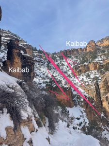
As we made our way down the hill, we were met by a surprising sight – the Kaibab Limestone. Déjà vu! The Kaibab was next to us, but across the valley it was far above us. At this point, Arlo gave a speech about how important it is that we observe the geology around us, think, and ask questions. He told us it was okay to be wrong, but we needed to try to come up with creative interpretations
“How is it that the Kaibab was above the Toroweap earlier on the trail and now its below it?” Arlo asked us.
“The beds are overturned,” Aiden answered confidently.
“You would have needed to flip the entire canyon upside down,” Arlo pointed out, gesturing at the majestic landscape.
Guess Aiden got a bit too creative that time.
“It’s a fault!” people began shouting. And this time we were right.
The fault in question, the Bright Angel Fault, is a massive normal fault associated with an extensional system (although the fault probably accommodated some compressional reverse motion during the Laramide Orogeny that built the Rocky Mountains). The valley we were hiking down was carved along the fault, taking advantage of the plane of weakness. The displacement along the fault is significant.
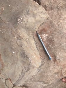
Next we ran back into our old friend, the Coconino Sandstone, which dates back to the Permian. The Coconino represents an erg or sand sea environment – think the Sahara Desert. We saw some massive cross bedding structures that would bring tears to Don’s eyes (if he was there with us – we missed you, Don!). The cross beds were formed from wind blown sand dunes, in this case as big as 15-20 meters tall. Now that’s a big erg! Also visible in the Coconino was the significant vertical throw of the fault, and some places where the sandstone was broken up along the fault line.

Below the Coconino Sandstone was the Hermit Shale, a soft red mostly muddy stone with some sandy layers. Its red color indicates the iron in the rock was oxidized, suggesting it formed in a terrestrial environment. In this case, the fine grained shale is indicative of a coastal plain type environment. The Hermit is very thinly bedded and lies at a roughly 25 degree angle of repose, forming a slope contrasting with the cliff forming rocks above and below it.
The Supai Group is a grouping of multiple different units deposited in the Carboniferous and the Early Permian. The units of the Supai group have lots of localized facies that vary laterally throughout the canyon, representing spatial changes in the paleoenvironment. The Supai Formation represents alternating aeolian and coastal environments associated with the transgression and regression of the Panthalassa Ocean.
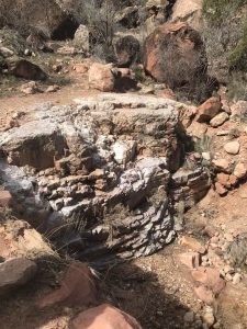
There is a disconformity between the Supai Group and the next unit – the Redwall Limestone, creatively named for… being red and… forming walls. A disconformity is where there is missing time between units that are parallel to one another. The disconformity in this case represents a jump from the Pennsylvanian to the Mississippian. The Redwall Limestone is a big package of marine limestone that was exhumed and weathered at the surface. Limestone weathers chemically, forming karsts (caves) and hummocky (kinda bumpy or wavy) surfaces. While the Redwall was at the surface, conglomerates and fluvial sediments deposited into the canyons on its surface. Those sediments are preserved today in isolated pockets at the contact between the Redwall and the Supai and are named (adorably) the Surprise Canyon Group. The paleonetwork of the fluvial system that deposited the Surprise Canyon Group can still be traced through the canyon.
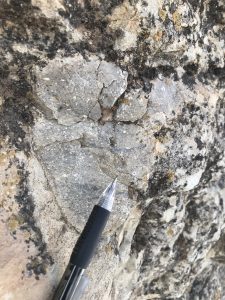
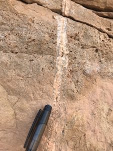
The Redwall Limestone, ironically, is not actually red! Its distinct color comes from staining from the units above. In the gully where the limestone is washed clean we saw its original grey color. We also saw some cool stylolites in the Redwall when we stopped for lunch. A stylolite is a concentrated area of phyllosilicates that concentrate together in a limestone due to compression. Stylolites run parallel to bedding. In fact, in many limestone you actually can’t see a divide between beds, but you can see the line defined by stylolites.
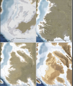
From our lunch spot we could see the Tonto Group, a group of Cambrian age rocks containing the Muav Limestone, the Bright Angel Shale, and the Tapeats Sandstone. The Tonto Group is the local manifestation of the most significant marine transgression event on Earth – the Sauk Transgression. We saw evidence of the Sauk Transgression on our Geo101 field trip to Valley Forge in the equivalent Ledger Dolomite, Antietam Sandstone, and Chickies Quartzite formations. Learning really does come full circle sometimes! The Tapeats Sandstone, the bottom of the Tonto Group, has lots of friends. It sits on top of the Chuar and Unkar groups of the Grand Canyon Supergroup, the Precambrian Vishnu Schist, and on top of the Sixtymile Formation (named for its type example at the 60 mile marker on the Colorado River – low hanging fruit!). On the cutting edge of science, the Sixtymile Formation just got designated as the bottom of the Tonto Group. The Sixtymile Formation was likely deposited in a valley formed by a grabben like those we saw yesterday. A graben is a block of rock flanked by two normal faults. As demonstrated by Arlo with a sharpie drawing on the back of his field guide, the Grand Canyon Supergroup forms a syncline on top of the Vishnu Schist. The spot where the Tapeats meets the Chuar and the Unkar is the Great Unconformity, and the place where it meets the Vishnu Schist is the Greatest Unconformity (we couldn’t make these names up if we tried). The Greatest Unconformity represents over 1 billion years of missing time!


Erdman and New Dorm love from your favorite supervisors,
Rosa and Adalia
Quote of the day: “I’m not a god, I’m just a Arlo” – Arlo Weil, 2023
Tallies:
Number of people who told us to put our crampons on (don’t you think we would if we had them?!) – 5
Number of fallen victims to the ice- 3
Number of side eyes Arryn gave to Arlo – too many to count