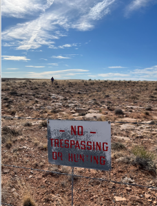
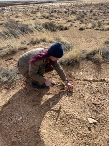
We’re back for day 2 of our Arizona geology extravaganza! We started the day waking up at the Best Western Sawmill Inn in the hoppin’ town of Heber-Overgaard. After a breakfast of bagels and protein bars we hit the road en route to the Petrified Forest National Park. Our first stop was slightly spontaneous at the Little Colorado River, a recurring friend on our travels today. Interestingly, the River used to flow in the opposite direction (northeast)! At our first stop we looked closely at some Permian age, very fine – fine grained sandstone in the Coconino formation that we were able to specify as quartz arenite. Arlo, Selby, and Don painstakingly led us to the conclusion that the sandstone formed in an aeolian, wind driven environment (desert dunes). Since the rocks are predominantly rounded, well-sorted quartz we know that the material is quite mature and went through various reworkings to get this way – meaning it was not one single event, but a combination of many. We saw great examples of cross bedding here as well. Other fun moments from this stop was Arlo “accidentally” trespassing, and Malin cracking open a piece of chert with a trusty rock hammer – Don recommends using another rock as a hammer to feel like a cave person.
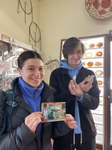
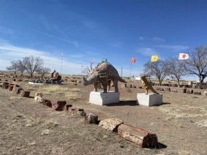
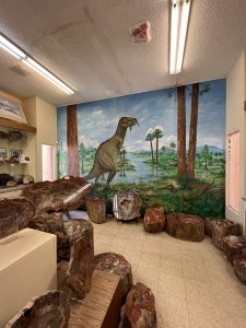
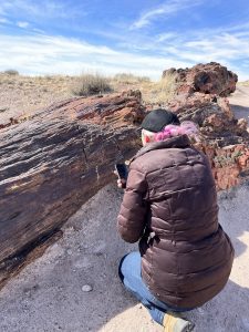
Next up we stopped at a little gift shop just outside of the entrance of the Petrified Forest. Here, we made all sorts of eclectic purchases including barite roses, child-size baseball caps, coasters, and shot glasses! They also had a wicked display of petrified wood – and super accurate dinosaur replicates ;).
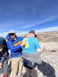
Once we were in the Park we made sure not to take any rocks or petrified tree bits as it is important to leave it all for the next visitors, and the ecosystem! Our first stop within the Park was behind the visitor center where we saw the Chinle formation of the late Triassic. Here, the wind claimed Allison’s hat, which Arlo illegally retrieved:). To set the scene: during the Triassic the earth was H-O-T and experiencing a lot of volcanism, and as all good things must come to an end, Pangea was on its final legs. Using Don’s convenient BMC geology shirt, Arlo lectured us on the formation of the region. Basically, on the eastern side of Pangea was the Panthalassa (dearly missed) which had a large magmatic arc system. On the other side of Pangea next to the Tethis, Pangea was starting to break up and new, buoyant oceanic ridges were opening up adding tons of CO2 emissions, and contributing to sky high sea levels. Arlo described this as a too-full bathtub, meaning quite a bit of land ended up underwater. Wow, then the Atlantic Ocean was opening, shoving the Americas to the west, all of this tectonic action did not actually result in mountain building, but man there were a lot of volcanoes – more on mountain building later this trip (keep your eyes peeled).
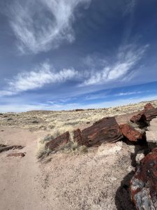
Maybe you, engaged reader, have noticed that we keep talking about how much volcanism there was, so where did all of this felsic volcanic ash go? The answer? Partially into the petrified trees we see today – WOAH! Volcanic ash is not like the ash found in us laypeoples’ fireplaces, no no, it is NOT organic matter. Rather, the ash is shards of glass. Continuing with bathtime metaphors, Arlo described the formation of the ash as suds in a bathtub, but the bathtub is a magma chamber with releasing pressure, instead of suds we call these bubbles vesicles – thin films containing volatiles from the magma chamber. When the volcano erupts and the volatiles are released, what is left behind are pieces of the hardened vesicles film in tiny shards. With tiny shards comes great responsibility. Due to their large amount of surface area, the shards weather rapidly, and go into solution in the groundwater. Conveniently, there are a lot of trees buried, but not decomposed, nor turned into coal, where the national park now stands. These trees (conifers and ginkgos the park believes), were just minding their business when all of a sudden, “hello there!” high silica content ground water is flowing through and around them, going cell-by-cell to replace the trees’ organic matter with silica. We call this silicification and is how we get petrified trees – and a shit ton of them at that
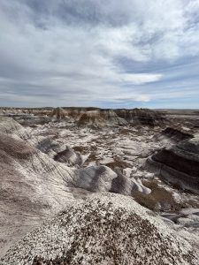
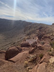
Our next stop was off the beaten path, i.e. road, on a hike called the Blue Forest Trail, which Arlo claims is for “expert” hikers, and not for the average National Park visitors. Before we began our hike, we made some quick lunches (sandwiches), despite the efforts of the wind, which was at a whopping 25 mph with 40 mph gusts. It was quite literally blowing peoples lettuces off their sandwiches, knocking people’s hats off their heads, and blowing us over as we were hiking up the Badlands topography, truly a force! We followed Arlo into a neat spot overlooking the Badlands topography for lunch, partly sheltered by the wind where Arlo took the opportunity to engage with our surrounding geology and ask, what caused the different coloration in their layers?
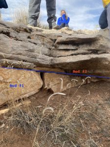
As per usual, we started with our observations. We noted we were still in the Triassic, on the Chinle formation. In the mounds there were different grain sizes in the different layers – some had pebble sized grains that were well rounded, while some were clay made of volcanic ash. From seds class, we know that to move big pebbles need high energy environments to move – here we thought high energy river channels would be the case. We also noted finer grains, which are from the flood plains of these rivers. The deposition on the flood plains and breakdown of vegetation on them created soil, which are now old, preserved soil horizons, or paleosols (Aviva will one day be a paleoSoll – ha). Since everything seems to comes back to volcanic ash in the Park, we also discussed how volcanic ash clay material called bentonite is present in these layers as well – interesting it expands significantly when wet! So once we established how the different grains came to be in the beds, what about the colors? Redox!! A chemical reaction that despite learning a 100 different times in my college career I (Aviva) still hardly understand ;). When the layers of sediment are buried or under water they are eventually cut off from oxygen, aka a reduced state. In this instance we are confident that it was flooding due to raises in the water table. But when the sediment is above ground and can be decomposed it is oxidized. The reduced state sediment is green-ish/gray, while the oxidized state sediment is red/purple/brown.
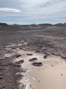
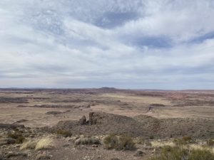
Our final stop within the Park was the Painted Desert, which is the lower Chinle formation locally known as the Bidahochi Formation due to its location within the Navajo nation. The approximate age of the formation is between 50 million years at the oldest and around 5 million years ago at the youngest. It showcases two major pulses of volcanic activity that affected the Western United States. This particular area of the Colorado Plateau during the Miocene was covered in large lakes. This changed as mafic material came up through the crust and interacted with the water above it (usually a lake), this interaction is known to most geologists, (and one biology and one linguistic major. No hate, much love <3) as “phreatomagmatic.” The Painted Desert is a special place because it consists of formations called Maars, the aftermath of phreatomagmatic events under lakes and is one of the largest Maar fields on Earth that we see today (300 of them here!). At this stop, a potentially retired geologist listened to Arlo’s spiel and said something along the lines of “there was a lot less subduction when I was your age” – Don thinks maybe because they didn’t know about plate tectonics then. New friend.
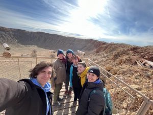
Our last, but not least (!), stop was the Meteor Crater Natural Landmark. Unfortunately it was “too windy” for us to go on the tour, but it did spare the guide from Arlo’s corrections (we were looking forward to that tally). The birth of Meteor Crater occurred about 60,000 thousand years ago during the Pleistocene in what is present day Arizona. The meteor was traveling at approximately 26,000 miles per hour, or 11 miles per second when it made contact with the Colorado Plateau, and was about the size of a Bowen 737 (no sponsorship). In just seconds the massive explosion created a one mile opening across and 550 feet deep (RIP giant ground clothes – gone but never forgotten). The meteor was made up of iron and nickel which can only be found at this density in planet cores, most of it melted on impact – because as Arlo said “if you were going 26,000 mph and hit the ground, you would melt too.” Isn’t it crazy that we were hit by an ancient planet core from the early days of our very own inner solar system, that exploded and flung chunks of its core to circulate outer space in an asteroid belt? The crater was certainly a BIG yam.
Today we visited Petrified Forest National Park, a region with a rich history for the Hopi, Zuni (territory), Pueblos, and Western Apache land peoples, US colonialism – including the establishments of the national parks, has removed them from the land that is their home. (Source: Native Land Digital).
Thank you for tuning in for day 2 of BMC’s Arizona Spring Geology trip! Come back tomorrow for more good times!
Xoxo,
G(ossip)eology Girl and JV Rock Jock
Quote of the day: “You are just a big bag of water with some rocks in it” – Don to Aviva
Geology joke of the day (sorry Selby): Q. What did the triassic wood tell the geologist? A. Nothing it was petrified. Ha!
Number of attempted robbery of hats by the wind: 4
Number of time Arlo lost Don on the road: ~4